Today is math storytelling day! I have a coloring sheet and some prompting questions for math fantasy writing posted.

#mapmaking
1 post1 participant0 posts today

88 years ago today, The Hobbit by J.R.R Tolkien was published. I still have my first copy that my parents gifted me at age 10. I was my gateway to modern fantasy and it also ignited a spark that ignited my interest in cartography map making which eventually became, a few decades later, my profession.

"All that has an undeniable hold on me still, but putting together this list, I found myself drawn to essays from diverse worlds that challenge how we think about maps and mapmaking."
Longreads · Map Room: A Radical Reading List on Cartographic Power, Perspective, and Possibility
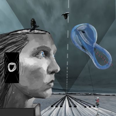
Eternal Realms - An invitation to discover fantasy worlds of storytelling, as you look down at a tavern table in a distant land of your choosing. Upon it, several items reinforce the mood and give away important cues. But the real focus is on the map, as it is evocative of a sense of adventure, that is fulfilled when we roll dice and share storytelling moments.

Love perusing a good map?
https://www.openculture.com/2023/12/the-history-of-cartography-the-most-ambitious-overview-of-map-making-ever-is-free-online.html
The University of Chicago Press has made available online — at no cost – five volumes of The History of Cartography.
What a tempting rabbit hole! 
For #throwbackthursday here is one of my favourite private commissions (who am I kidding? I love them all, seriously!) from a little while ago. A GM’s home brew setting is one of the coolest things to bring to life in a map!

#storySeedLibrary is proud to introduce a new author who shared his work under a #creativeCommons license, #grasshopperGeography !
https://storyseedlibrary.org/art/grasshopper-geography-india-and-china/
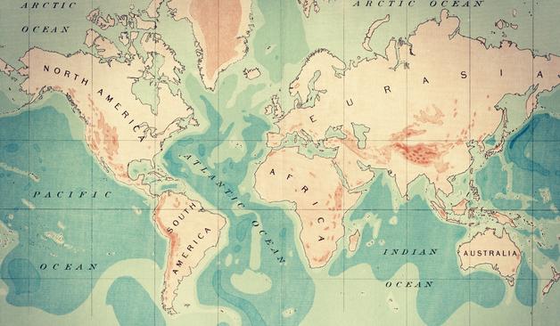
It's a map of Asia divided not by countries, but by river basins, watersheds - the most natural way of dividing land. A beautiful #solarpunk symbol.
It's also available as a print in the artist's store! https://www.grasshoppergeography.com/products/river-basin-map-of-india-and-china-with-black-background-fine-art-print
Story Seed Library · River basin map of India and ChinaA library of Solarpunk art and story seeds, visions of an optimistic climate future.
From entire continents, to regions, cities and dungeons, all the maps I create go through three stages of development: sketching, inking and colouring with various levels of complexity.
Come for a visit and ask me about a commission!

After a long, long time, I am trying to get back into #krita . So I could use some advice: What brushes do you recommend for drawing hachures?
#DigitalArt #mapmaking
https://en.wikipedia.org/wiki/Hachure_map
en.wikipedia.orgHachure map - Wikipedia
I bought my old #Wacom Cintiq digital drawing tablet during a time in my life when I (a) earned a lot more money than I ever had before and had yet learned to budget properly, and (b)still had the subconscious belief that buying [stuff] for [interest] would somehow transform into [skill] in [interest].
Now, of course, I am older and wiser and know better. Still, I finally bought a desk that is large enough for both my main screen for my desktop PC _and_ my Cintiq, so I should figure out ways I finally get some use out of it. The most likely use case #DigitalArt that I can see is some #TTRPG #MapMaking - I already do some mapping with #Inkscape, but I could use the tablet to make the maps fancier - as well as do some quick sketches for my current Ptolus campaign.
Any other ideas, keeping in mind that my artistic skills outside of mapmaking very much rate as "beginner"?

A real cartographer, used to working with real geographic data, decides to try his map making skills on a ‘fantasy’, game-inspired world: specifically Sid Meier’s Alpha Centauri. This essay is a deep dive into the technical aspects of what it took for him to make the map, and the difference between making traditional real-world maps and fantasy maps. A small group of you may be interested in his journey, and the story he tells. #Maps #Cartography #MapMaking #AlphaCentauri
https://somethingaboutmaps.wordpress.com/2025/05/20/planetfall/
somethingaboutmaps · PlanetfallGentle readers, I have just wrapped up a fun side project that will be of great interest to a very small number of you. The result of one of the most technically demanding efforts of my career, I a…
Here’s a rather unbalanced encounter, as they can often be in Dragonbane, one of my favourite tabletop RPGs! Did you know that many of the items on this photo are available from my store, some are even FREE! Come for a visit:
https://thevoyagersworkshop.com
Lies of the Land: Painted Maps in Late Medieval and Early Modern France by Camille Serchuk, 2025
Lies of the Land examines the often-overlooked artistic roots of mapmaking practice in early modern France, offering an original perspective on discourses of accuracy and their relationship to the pictorial origins of modern mapmaking.
@bookstodon
#books
#nonfiction
#cartography
#mapmaking
#maps
#history
#France
Just published! This historic novel about a young German cartographer who finds employment with renowned 17th century publisher Joan Blaeu in Amsterdam.
The novel by Mark Boog is in Dutch. Hopefully it gets international attention and will be published in other languages somewhere in the future.

One thing I am struggling with in #Inkscape #cartography is representing physical objects where one side is in shadow.
It's simple enough to put down drop shadows, but in the case of city maps (and mountain ridges, for overland maps) you have two sides of an object where one side is brightened by sunlight, and the other one is shaded.
I _could_ just place the shadowed side manually (and this is fairly easy to do for houses), but ideally I'd like to automate the process, where the level of brightness or darkness is dependent on the rotation angle of the overall object.
But I suppose that's a bit too complex for Inkscape, and would require actual 3D software.
I've added my first swamp to the map. How do you like the style?
I am trying to figure out a quick and dirty way of drawing small forests on "local" maps with #inkscape , similar to what other maps are doing manually (example from a RuneQuest map to the left, my drawing on the right).
What are your thoughts?
A question: Does anyone have any good ideas for a map symbol for "haunted" that fits with the design aesthetics for 19th century maps (such as the ones on the linked reference sheet)?
The reason for this is that German folklore features numerous locations that were used as "dumping grounds" for onery ghosts and evil spirits which people did not want in their homes - the exorcists simply bound them to a remote swamp, forest, hill, or whatever, where they could no longer bother the living.
So in a world where the supernatural is real and such practices existed, conscientious surveyors would surely mark these sites on their maps...
#ttrpg #dnd #cartography #mapmaking
https://static-cdn.arcanum.com/media/mapire/legend/porosz_b_iva_135_jelmagyarazat.jpg
Now trying to work out a process for portraying wetlands in #Inkscape .