
Okay - further to my early rants about CDSE data, it aint as bad as I thought  it also prompted me to properly sort out my approach to scaling/offsets which had been driving me mad! So if anyone cares for another way to download data from CDSE, with #rspatial / #gdal I made a gist:
https://gist.github.com/h-a-graham/86cd3403445cf163ce958efa2d29c621
There are still some improvements to be made for sure.
FYI @Micha_Silver


 ¡Nueva edición del libro Usa R como Sistema de Información Geográfica!
 Puedes descargarlo gratuitamente en formato digital aquí:


 A heads-up about the Geocomputation with R book: some copies were mistakenly printed in black & white instead of full color. If you received one, please contact me or the publisher for a replacement. A new, correct copy will be sent to you!


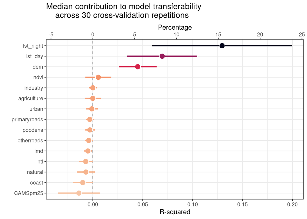
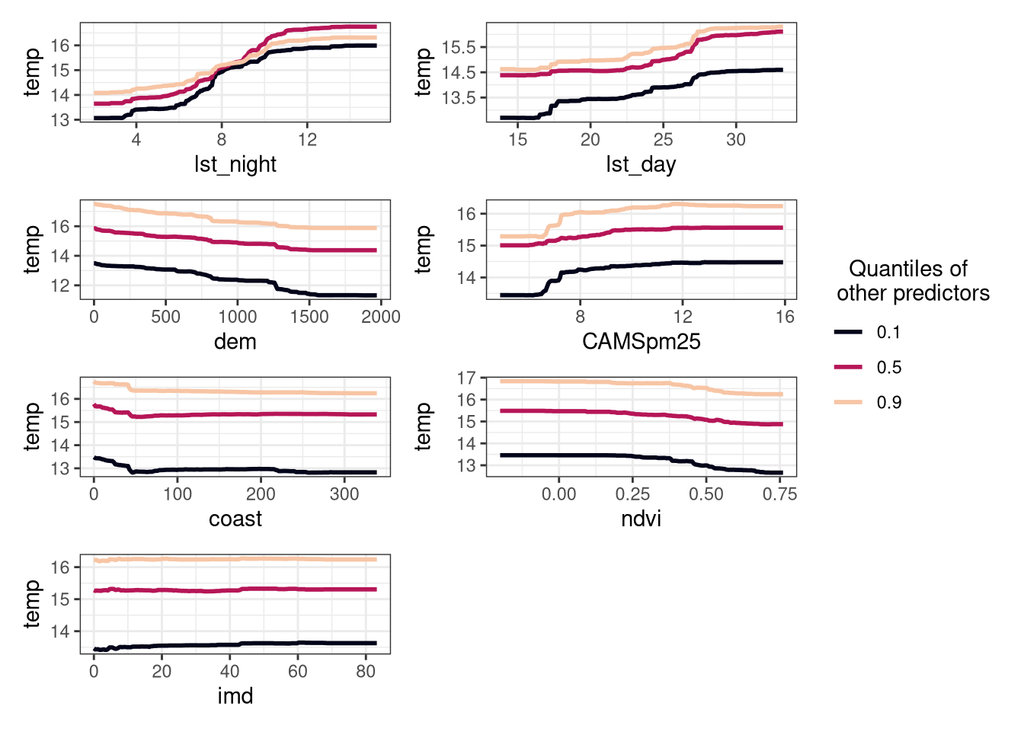
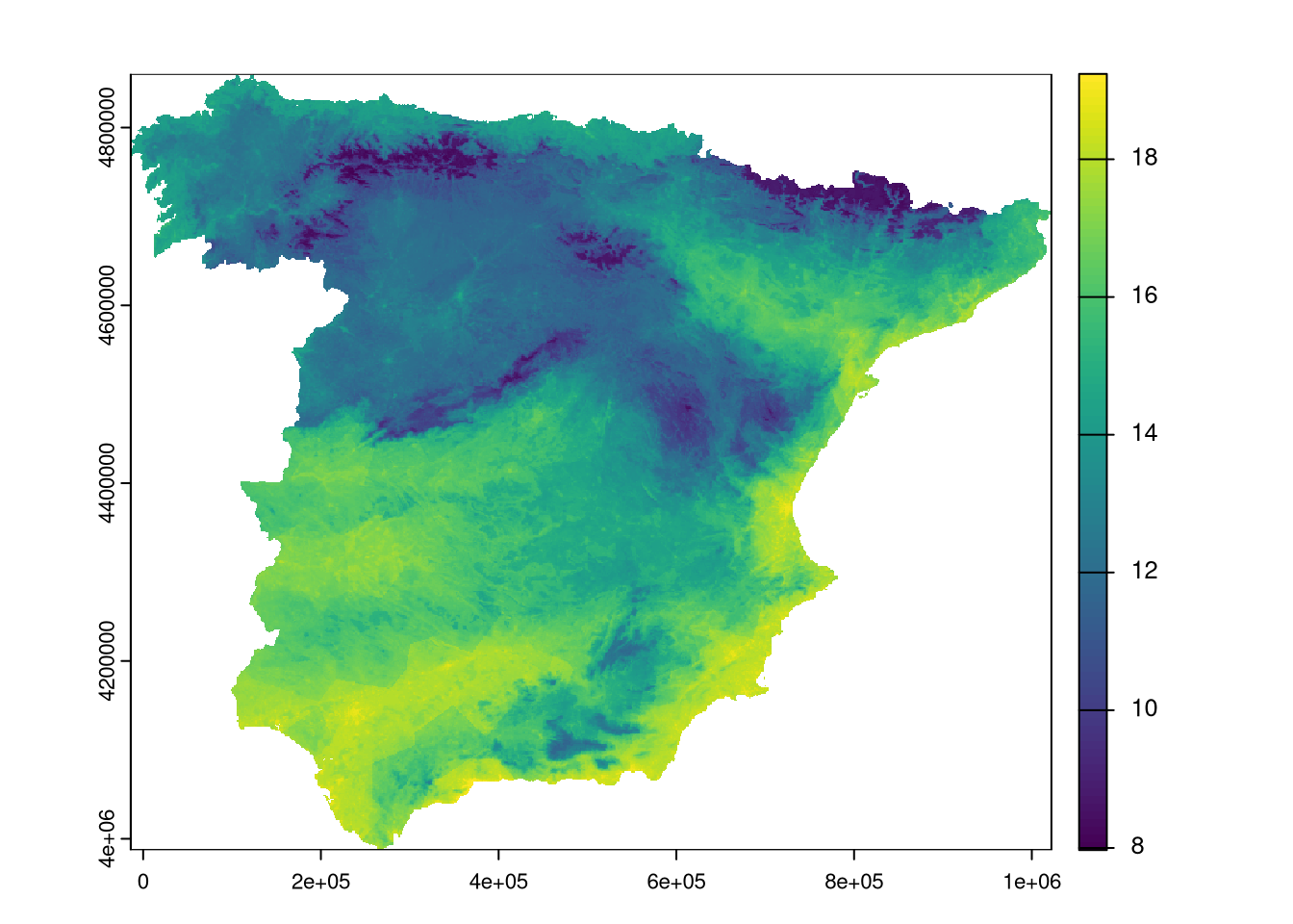
 New blog post! Part 5 of our series on spatial ML with
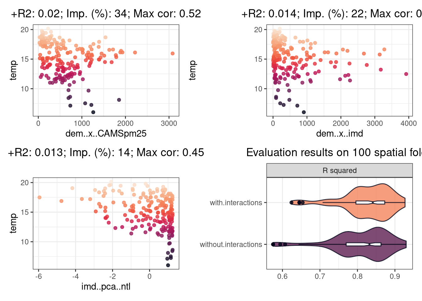


 Registration is open for Spatial Data Science across Languages (SDSL) 2025 – Sept 17–18 (+19), Salzburg, Austria.
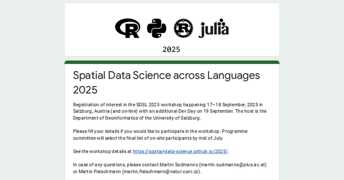


 :
GDAL Error 1: PROJ: proj_create_from_database: /g/data/hh5/public/apps/miniconda3/envs/analysis3-24.04/share/proj/proj.db contains DATABASE.LAYOUT.VERSION.MINOR = 2 whereas a number >= 5 is expected. It comes from another PROJ installation.
Error: crs not found: is it missing?")


Add data as \"sources\" - your sf objects become data sources
Add \"layers\" that reference those sources - these are like geoms but work differently
Style with expressions - not aesthetics, but JavaScript-style expressions
This is more like how a web developer builds an interactive map, which is why it's so powerful for complex visualizations.
Before I show you the syntax, let me test your intuition: If you had to guess, how do you think you'd start building a mapgl map differently than a ggplot? What do you think comes first - the data or something else?
And here's a follow-up: Given that mapgl creates interactive web maps, what do you think might be the equivalent of choosing your x and y variables in ggplot2?")
 The 2nd edition of Geocomputation with R is now available as a physical book!


 Quick trick: subsetting the BIOCLIM CHELSA dataset by the Swiss Federal Institute for Forest, Snow and Landscape Research WSL using Cloud Optimized Geotiff (COG) functionality in R.