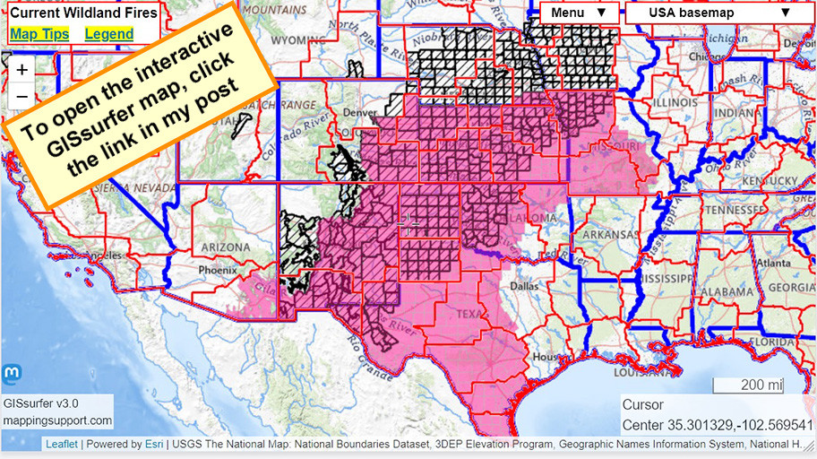
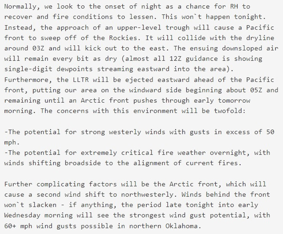
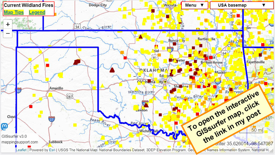
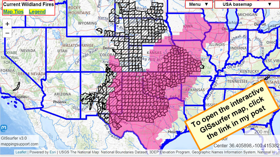
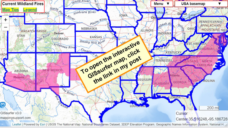
Various wildfires are burning in Texas and Oklahoma.
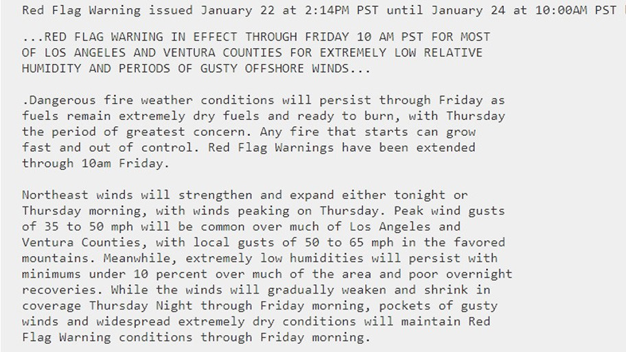
This area has both a #RedFlagWarning and #HighWindWarning.
Blowing dust is also an issue.
I-40 is reported to be closed east of Amarillo due to #Wildfire and accidents.
Dark symbols on the map are satellite heat detections within the prior 6 hours. This data is not real time and locations are only approximate. Typically there are 8 satellite passes per 24 hours. I think the next update will be this evening.
Some newer fires, like the one along I-40 in the Texas panhandle, have not yet been detected by the satellites.
To search on an address, open the map and click/tap Menu > Search.
#TXfire #OKfire #TXwx #OKwx
Open GISsurfer map:
https://mappingsupport.com/p2/gissurfer.php?center=35.626014,-98.547087&zoom=7&basemap=USA_basemap&overlay=VIIRS_7_day,MODIS_7_day,State_boundary&data=https://mappingsupport.com/p2/special_maps/disaster/USA_wildland_fire.txt


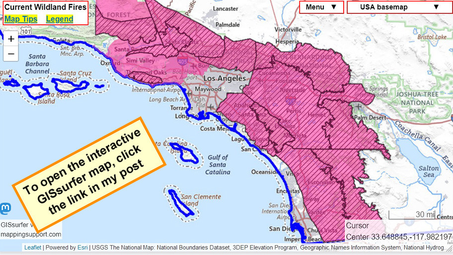
 Cobb County daily and extended weather forecast, along with the regional climate summary: Saturday, March 22, 2025


 A critical Red Flag Warning is in effect for Cobb and surrounding counties in the metro Atlanta area for Saturday March 22