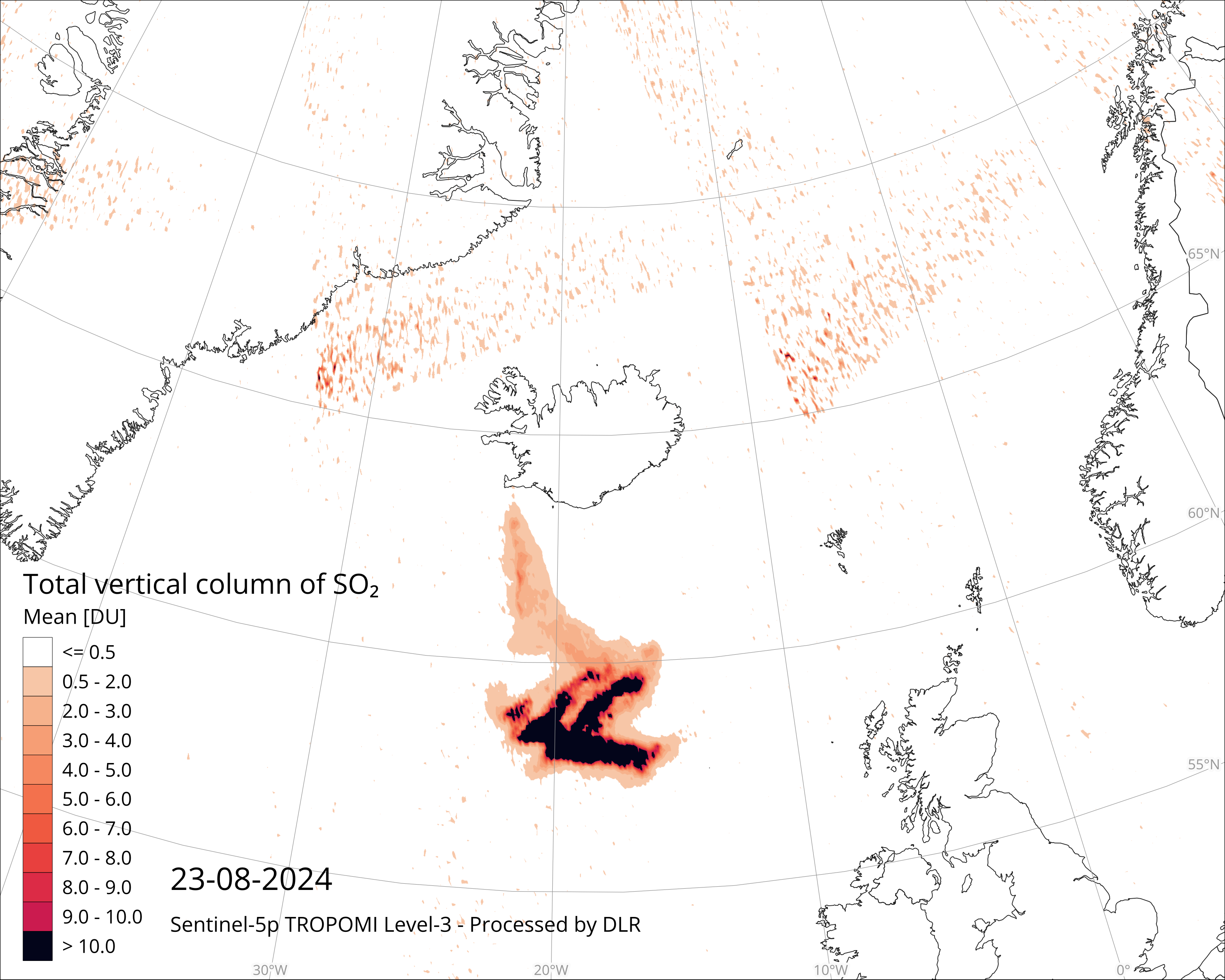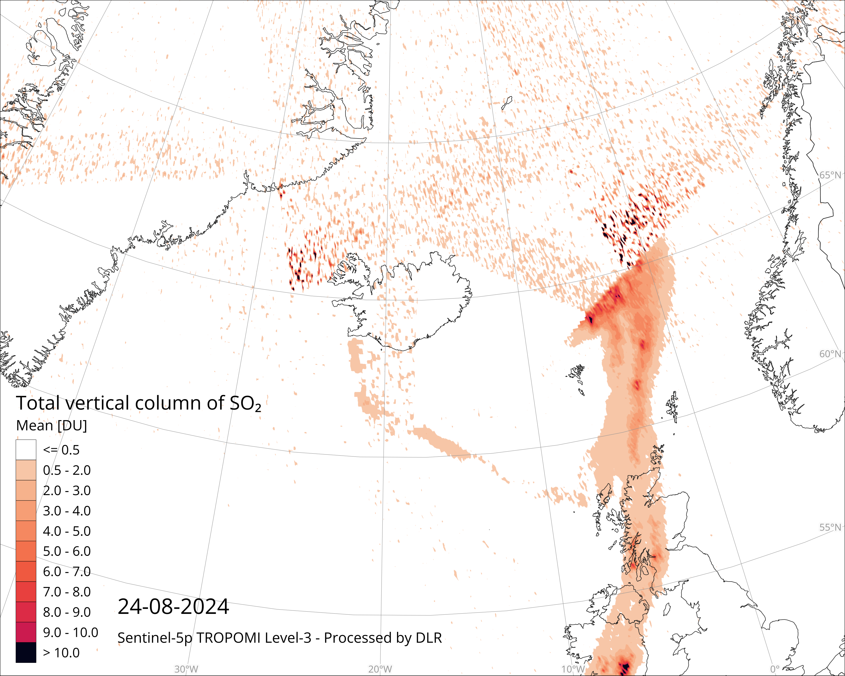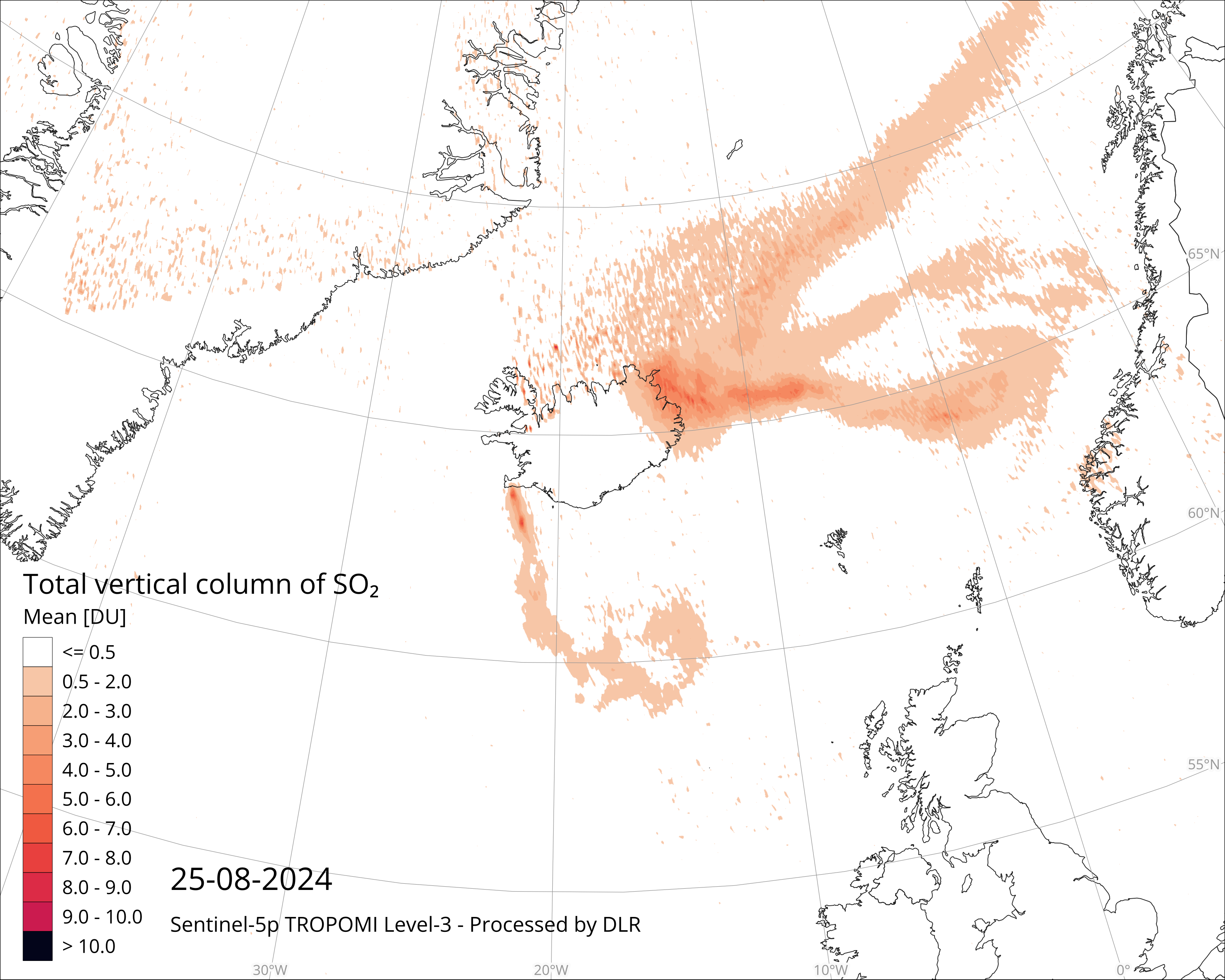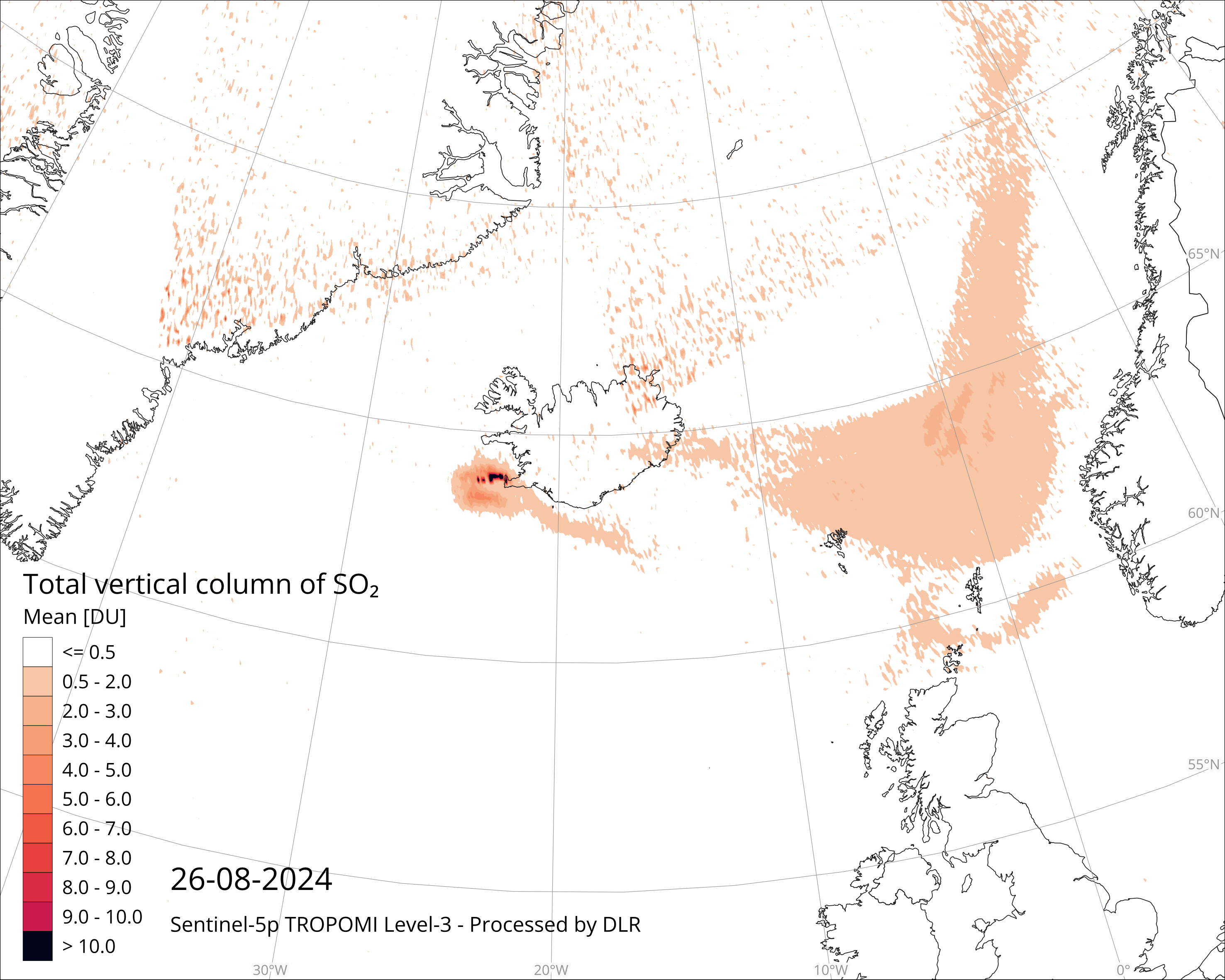
𝗖𝗙 𝗠𝗲𝘁𝗮𝗱𝗮𝘁𝗮 𝗖𝗼𝗻𝘃𝗲𝗻𝘁𝗶𝗼𝗻𝘀 support #OpenScience by automating processes via metadata in #NetCDF and #Zarr files. They establish a unified language for the #weather, #climate, #ocean, and #EO community. https://buff.ly/rGPuoku
#remotesensing #EarthObs
ZenodoSupporting Open Science with the CF Metadata Conventions for NetCDFSlides for the presentation given on 11 December 2024 at the AGU Annual Meeting to the session for the AGU Open Science Recognition Prize. Abstact:The CF (Climate and Forecast) Conventions are a community-developed standard that promotes the sharing and automated processing of Earth systems science data in the netCDF data format (and in Zarr/GeoZarr). The CF conventions define metadata that can be used to describe the coordinate systems, data structure, and geophysical meaning and units of each variable. This enables users of data from different sources to decide which quantities are comparable and facilitates building applications with powerful extraction, analysis, and display capabilities. There is a mature and growing ecosystem of FOSS (Free and Open Source Software) and commercial software tools which work with CF. The CF standard has been essential to the success of high-profile internationally-coordinated modeling activities (e.g, the Coupled Model Intercomparison Project, which hosts more than 30 million files and more than 15 petabytes of data, all compliant with CF). CF is widely used by weather, climate, ocean and Earth observation scientists, and is gaining traction among others, such as the biogeochemistry and atmospheric chemistry communities.


 Greg Cocks
 Datasets are structured into three fundamental group types based on content and data geometry. The Survey group contains general metadata about the dataset. Unstructured datasets, such as from CSV or TXT files, form Tabular groups, whereas structured (gridded) datasets are categorized under the Raster group. Metadata is attached to all groups, with various required attributes (green text) that expands on the CF-1.8 convention. (B) Groups follow a strict hierarchy in the NetCDF file, with a single Survey group at the top to which all data groups are attached. Datasets are indexed within their respective group type. (C) Tabular and Raster data groups must contain clearly defined dimensions, such as index or x, y, z, as well as coordinate variables. Raster groups are distinct in that dimensions are also coordinates, whereas Tabular datasets are assigned spatial coordinates that align with the index dimension. Lastly, the coordinate variable “spatial_ref” is required for all data groups, which expands on the “coordinate_information” variable required in the Survey metadata.")